Welcome to Dartmoor Hexworthy Walk
Route Details
Terrain: One strenuous climb from Week Ford to Combestone Tor. Easy going along roads and defined tracks. Route crosses stepping stones.
Time: approx. 2 ½ hours
Distance: 5km (3 miles)
Facilities: Toilets at Dartmeet car park
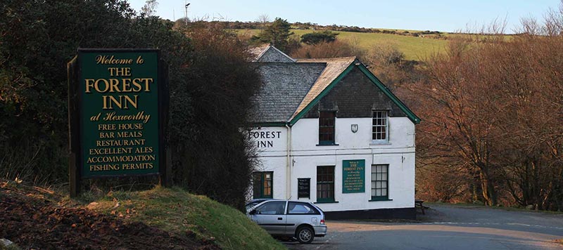
Parking: layby outside the Forest Inn
Summary: This walk takes you through historic farmsteads, medieval pack horse routes, and a landscape steeped in tin mining history. Learn more about Dartmoor whilst taking in the incredible views on this short walk.
Download route1. Historic Farmsteads
To start your walk follow the road downhill from the layby with the Forest Inn on your left. Continue along the road, the road will turn into a farm lane. The footpath takes you along this short lane and through the farmyard where you will pass Hexworthy Farmstead. The group of farmsteads at Hexworthy date to the medieval period when they were one of the ‘Ancient Tenements’. The occupants of these farms had special rights allowing them to farm within the Royal Forest of Dartmoor in return for undertaking various duties, especially rounding up animals grazing on the moors.
Walk past the houses and through a small gate. After the gate, take the bottom gate out of the farmyard and into the field. Follow the wall keeping it on your right. At the end of the wall go over the stone stile and bear right into the next field, walk diagonally across the field to the bottom right hand corner and over the next stone stile. Follow the footpath down the hill to the bridge.
2. Medieval Meanderings
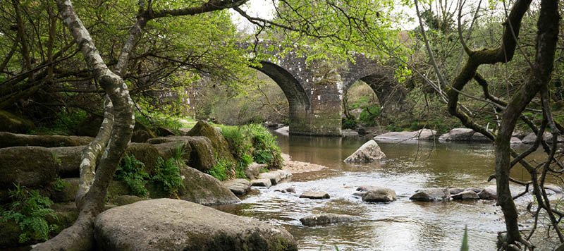
Carefully make your way over the stone stile and onto the road, follow the road round to your left and over the bridge. Carry on along the road, you are now walking along part of an old pack horse route. Before the construction of toll roads in the late 18th century, these medieval routes ran between linked important towns and this one linked Tavistock and Ashburton. It would have originally been marked by guide stones, today much of the route has been replaced by modern roads.
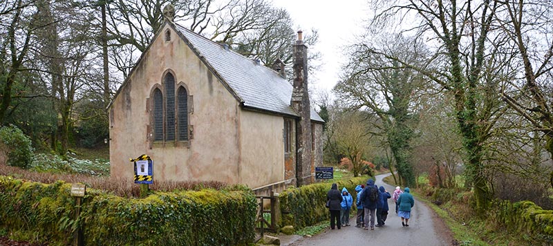
Stay on the road until you reach the small church of St Raphael’s, which was built in 1869. A mission chapel, bringing the gospel to those who lived too far from the parish church in Lydford, which required a lengthy passage across Dartmoor to visit. The chapel was a place of worship on Sunday and acted as a school during the week, the scholar’s desks remain in place today and are used as pews. After the church, take the track on your right just above the gateway and follow it round to your right.
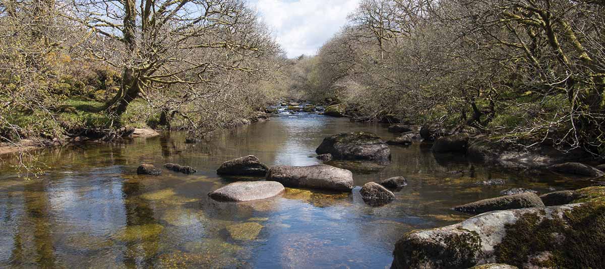
3. Week Ford Tin Mills
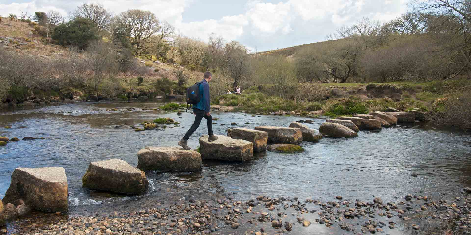
Go through the gate and follow the track, keeping right and continuing downhill to the river and the stepping stones.
The Week Ford tin mills are well preserved examples of structures that would have been common on Dartmoor between the 15th and 17th centuries, crushing and smelting the tin mined in the region. The larger building would have contained a furnace driven by bellows powered by a water wheel. Today, the two mills are visible as the remains of substantial rectangular buildings with the pits which held the waterwheels and the leats which supplied them with water clearly visible.
Carefully cross the stepping stones and follow the river round to your left, across a stream and past an old fence. Follow the bridleway up the hill, with the fence and wall on your right (it does become steep and rocky at times). Follow the way markers as you go until you come to a cattle grid and gateway. Go through the gate and follow the track up the hill until you come to the road.
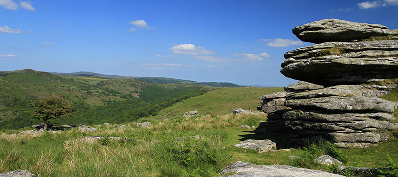
4. A Landscape Shaped by Humans
Once at the road, turn left and walk up the hill a few metres to stop at Combestone Tor and take in the views. The landscape you can see here is one that has been shaped by humans over 1000s of years.
If you look carefully, especially to the south of the road, you will notice low, stony banks running across the ground from north to south. These are the remains of field boundaries dating to the Middle Bronze Age, around 1,500 BC. They are part of the Dartmeet ‘reave’ system, an ancient preserved landscape of fields which is of International archaeological importance. It stretches for around 6km north to south and 4km east to west and includes trackways and the remains of the roundhouses in which the people who farmed here lived.
To return to your car follow the road downhill and continue on the same road until you reach your car and the pub for a well-earned rest.